Imagine the footprint of the Deepwater Horizon oil dispersion roughly centered on your home town. Here is what it looks like in New Mexico. ......click on heading and see the image
A Michigan software developer has created a map that plops the spill area on top of any location on the globe, and updates the area as it grows.
Note that the current area of the Deepwater Horizon oil catastrophe (mid-June 2010) now covers about three times the surface area of solar photovoltaic panels required to power the current annual electrical demands of the USA.
In the Name of Sustainability--A New Community Rights Movement

In the Name of Sustainability--A New Community Rights Movement
NMCCR Statewide Symposium on Community Rights for New Mexico
“In the Name of Sustainability: A New Community Rights Movement” Speaker: Thomas Alan Linzey, Esq.
Open to the public , suggested donation, open to all
• Santa Fe Evening Presentation with Thomas Linzey
Co-sponsored by We Are People Here ! WAPH!, New Mexico Coalition for Community Rights, NMCCR
Date: Saturday, November 2nd, 2013
Time: 7:00 pm – 9:00 pm
Where: Unitarian Universalist Congregational Church UUCSF
Sanctuary
107 West Barcelona, Santa Fe
(intersection of Galisteo and Barcelona)
• Taos Evening Presentation with Thomas Linzey
Co-sponsored by Renewable Taos, PPC Solar, New Mexico Coalition for Community Rights, NMCCR
Date: Sunday, November 3rd, 2013
Time: 6:00 pm – 8:00 pm
Where: Taos County AG Center
202 Chamisa Rd., Ste. B
(behind the Comfort Suites)
• Las Vegas Evening Presentation with Thomas Linzey
Co-sponsored by NM Highlands University- Conservation Clu,b
Committee for Clean Water, Air and Earth, CCWAE,
Casa de Cultura, New Mexico Coalition for Community Rights, NMCCR
Date: Monday, November 4th, 2013
Time: 6:00 pm – 8:00 pm
Where: Ilfeld Auditorium, Highlands University Campus
For more information call:
Kathleen Dudley, NMCCR Chair 575 666 2529
visit website: www.nmccr.org
Upcoming Democracy School, Santa Fe, NM
The Alliance for Real Democracy, ARD, is organizing and hosting the CELDF Daniel Pennock Democracy School in Santa Fe, New Mexico in April.
DATE: Friday evening, April 19th, 2013
Saturday, April 20th
Sunday, April 21st
PLACE: Santa Fe--location TBA
WHAT: Thomas Linzey and Mari Margil, the Community Environmental Legal Defense Fund, CELDF, will present the Democracy School and a strategy session on Sunday.
Find out how to join in with over 150 other communities to assert your rights to protect your community from corporate and state pre-emption and challenges to your community livelihood.
Please contact Kathleen Dudley for application forms at KathleenDudley@nmccr.org or call 575 666 2529.

ALERT!!!! Las Vegas, NM AND Royal Dutch Shell & Cannon Air Force Base
Thursday, June 21st, Royal Dutch Shell and Cannon Air Force base folks will speak during a statewide Association of Counties conference to our locally elected municipal commissioners and council people.
Come let them know that you do not agree that this quasi government organization has the right to engage our government in corporate indoctrination.
The meeting begins at 9:30 AM Thursday with Shell presenting. Come and let them know your position on poisoned water and air.
Come let them know that you do not agree that this quasi government organization has the right to engage our government in corporate indoctrination.
The meeting begins at 9:30 AM Thursday with Shell presenting. Come and let them know your position on poisoned water and air.
Thomas Linzey, senior legal counsel, CELDF

COMMUNITY RIGHTS with THOMAS LINZEY, CELDF in Las Vegas
DATE: Saturday, June 2nd, 2012
TIME: 7:00 PM
WHERE: Luna Community College, TBD, Las Vegas, New Mexico
WHAT: Elevating Community Rights Above Corporate Rights
April 2nd, 2012, the City of Las Vegas Council passed the "Las Vegas Community Water Rights and Local Self-Government Ordinance" protecting citizen rights by banning fracking. Come listen to Thomas Linzey talk about this council's progressive support of community rights for the citizens of Las Vegas, NM

LAS VEGAS Mayor & Democracy
DATE: Wednesday, May 23rd, 2012
TIME: 6:00 PM
WHERE: Las Vegas Council chambers, NM
WHAT: Democracy is in trouble in Las Vegas, NM Come to City Hall and help put it back on track (See attached flyer)
ACTION: If you cannot attend, please call Mayor Alfonso Ortiz and let him know your thoughts on his actions: 505-426-4439
TIME: 6:00 PM
WHERE: Las Vegas Council chambers, NM
WHAT: Democracy is in trouble in Las Vegas, NM Come to City Hall and help put it back on track (See attached flyer)
ACTION: If you cannot attend, please call Mayor Alfonso Ortiz and let him know your thoughts on his actions: 505-426-4439
In Solidarity--Stop Fracking

WORK SESSION WITH THOMAS LINZEY, CELDF--Mora County
The Commission will hold a "Work Session" this Monday. Thomas Linzey, senior legal counsel for CELDF will discuss the "Mora County Community Water Rights and Local Self-Government Ordinance" via Skype. Find out how a rights-based ordinance can ban corporations from polluting Mora County's water and stop drilling in the county.
DATE: Monday, April 23rd, 2012
TIME: 6:00 PM
WHERE: Chet fire department, Cleveland, Mora County, NM
DATE: Monday, April 23rd, 2012
TIME: 6:00 PM
WHERE: Chet fire department, Cleveland, Mora County, NM
Miguel Santistevan

WEALTH OF WATER: Short Term Gains VS. Long Term Opportunity presented by MIGUEL SANTISTEVAN
DATE: Monday, April 16th, 2012
TIME: 4:00 PM children presentation, 5:00 PM adult presentation, 6:30 PM showing of GASLAND documentary
WHERE: Tapetes de Lana, Mora, Mora County, NM
WHAT: Come listen to Miguel Santistevan, native of Taos NM, active acequia parciante and past Mayordomo, as well as board member for the Taos Valley Acequia Association.
Miguel will talk about the differences between wealth and riches. What is real wealth? The infinite possibility to have riches in the future with our water.
Free tamales and refreshments!
LAS VEGAS COMMUNITY BILL OF RIGHTS ORDINANCE
Meeting for the Las Vegas City Council Vote:
DATE: Monday, April 2nd, 2012
TIME: 4:00 PM
WHERE: City of Las Vegas Council chambers
1700 North Grand Avenue, Las Vegas, New Mexico
Directions: take Grand Avenue north, cross Mills Avenue and the next right (Rec Center across the street)
DATE: Monday, April 2nd, 2012
TIME: 4:00 PM
WHERE: City of Las Vegas Council chambers
1700 North Grand Avenue, Las Vegas, New Mexico
Directions: take Grand Avenue north, cross Mills Avenue and the next right (Rec Center across the street)
Mora Democracy School in Mora, NM
Democracy School will be presented online in Mora, NM this Saturday--Free event sponsored by the Mora Democracy School Committee--
DATE: Saturday, March 24th, 2012
TIME: 9:00 AM
WHERE: Tapetes de Lana, Mora, NM
WHAT: Join us for an online introduction to the Democracy School and the Community Rights movement. Learn how the rights protecting commerce and property, combined with the constitutional bestowal of the rights of personhood, have given corporations a controlling interest over our nation, our democracy, our people and the very land we walk on. We are occupied!
CALL MDSC at 575 666 2529 to participate
FREE catered lunch by Theresa's Tamales
Mora County Community Rights: FACEBOOK
Mora Community Rights: Sacred Water, Land, Air and Life:
IN SOLIDARITY--PLEASE ATTEND
DATE: Wednesday, March 21st, 2012
TIME: 6:00 PM
WHERE: City of Las Vegas Council chambers 1700 North Grand Avenue, Las Vegas, New Mexico
DIRECTIONS: Take Grand Avenue north, cross Mills Avenue and the next right (Rec Center across the street)
This Wednesday, March 21st, 2012, the City of Las Vegas, NM,. will vote to adopt the first community rights based ordinance to be brought to a vote in the Southwest.
Come join in solidarity at the meeting to show the residents of Las Vegas and the city council your support for taking a stand in protection of Nature and people over corporate rights. Please bring others with you. Our chance to open up New Mexico to citizen rights is here, this week in Las Vegas!!!
Santa Fe Community Rights Ordinance
 It is time for a change in order to address
environmental and public health impacts from Los Alamos National Laboratory. Santa Fe County needs a carefully written and agreed-upon community rights-based ordinance that asserts the powers it has to protect its water, air and land—our inalienable rights! There is no “no” in the regulatory system. It is only about how much harm and how much destruction will be regulated.  A gathering of interested people will be held:

Date:   Tuesday, February 21
Time:   5:30 to 7:30 pm
Where:  Santa Fe Main Library
What:   Develop community support for a Community      Bill of Rights for Santa Fe County.  Please join us!
"Protecting New Mexico: Elevating Community Rights Above Corporate Rights"
DATE: Thursday, February 2nd, 2012
TIME: 7:00 PM
PLACE: UNM Albuquerque, Education Lecture Hall Room #103 (250 feet directly north of the Student Union Building on UNM Campus. It is on the first floor (west side) of the Education Bldg which is located just past (and down the steps) from the white/blue water fountain)
WHAT: Thomas Linzey, senior legal counsel for the Community Environmental Legal Defense Fund, CELDF, will speak on communities facing corporate challenges and will discuss how communities can exert their inalienable rights to protect their communities and develop their local sustainability.
For more information, email drillingmoracounty@gmail.com or call 575 666 2529
DEMOCRACY SCHOOL COMES TO ALBUQUERQUE, NEW MEXICO!
February 3-4th, Thomas Linzey, senior legal counsel and Ben Price, projects director, the Community Environmental Legal Defense Fund (CELDF) will present the Democracy School to community leaders and elected community officials.
Whether you are facing large water extractions, hard rock mining, oil and gas drilling, factory farms, or any other corporate development that threatens your community's water, air, land, health and safety, the Democracy School addresses these issues and offers solutions for local communities.
For more information contact 575 666 2529 or email drillingmoracounty@gmail.com
GASLAND, a documentary

CURRENT EVENT--MORA
•• The Mora Democracy School Committee proudly presents the showing of the new documentary "GasLand" by Josh Fox.
A stunning portrayal of the tragic and endemic impacts natural gas drilling and hydraulic fracturing have on communities and ecosystems from NY & PA west to the rocky Southwest states including, New Mexico.
Date: Wednesday, August 31st, 2011
Where: Tapetes de Lana, Mora, NM
Time: 6:30 PM
Popcorn and refreshments will be served
UPCOMING EVENTS
•• DEMOCRACY SCHOOL--Drilling Mora County proudly presents, Community Environmental Legal Defense Fund (CELDF) with constitutional scholar, Thomas Linzey, esq. and Ben Price of CELFD in a Mora County "Democracy School."
Date: Friday June 3rd and Saturday, June 4th, 2011
Place: Mora, New Mexico
Location: TBA
Time: Friday: 6:00pm-9:00 pm & Saturday: 9:00 am-6:00 pm
Call for reservations for this event. Limited to 25 people.
575 666 2529
for more information: www.celdf.org
Date: Friday June 3rd and Saturday, June 4th, 2011
Place: Mora, New Mexico
Location: TBA
Time: Friday: 6:00pm-9:00 pm & Saturday: 9:00 am-6:00 pm
Call for reservations for this event. Limited to 25 people.
575 666 2529
for more information: www.celdf.org
DEMOCRACY SCHOOL
Drilling Mora County hosted the Community Environmental Legal Defense Fund (CELDF--www.celdf.org) August 2010 Democracy School in Wagon Mound. Our rights to local self-governance, clean air, water, ecosystem, and health are inalienable birth rights, andthey are not only our rights, but our responsibility to protect these rights as well as to give a voice to the Rights of Nature--to protect with our voice, our vote, our actions. When we, the citizens, do not stand up for our rights, we, in essence, give them up to corporate, state and federal interests.
Today, as throughout history, it has been "the people" who have stood up, changed undemocratic and harmful existing laws. Stand up for your rights! And if not for yourself, for your children!
Today, as throughout history, it has been "the people" who have stood up, changed undemocratic and harmful existing laws. Stand up for your rights! And if not for yourself, for your children!
UPCOMING EVENTS-Drilling Mora County Educational Forum with Weston Wilson
Weston Wilson, EPA environmental Engineer, presented to Congress October 2004 that the EPA Allows Hazardous Fluids to be Injected into Ground Water in the hydraulic fracturing process.
Today Wes comes to Mora to talk about his findings, his ongoing research and testimony and what natural gas extraction and hydraulic fracturing could do to the water in Mora County.
Date: Thursday, July 22nd, 2010
Time: 6:30 pm
Where: VFW, Mora, New Mexico, Main Street
Come attend this informative and educational event!
RADIO INTERVIEWS
- Hydraulic Fracturing: Mike Soraghan from Greenwire and the next 20 min segment involves Lee Fuller of Energy in Depth, an industry rep. and Weston Wilson, EPA, retired
- 12-2010 DMC Cultural Energy Interview
- Adver. San Juan Co. Presentation
- KTAO RADIO INTERVIEW W/SAN JUAN CO. RANCHERS
- Adver. San Juan County presentation
CURRENT--BASELINE water well and surface water testing
Baseline water well and surface water testing in Mora County possible soon. Protocols and testing in counties in Colorado and Wyoming by citizen groups and the EPA help direct the necessary steps to ensure that Mora County citizens know the quality of their water BEFORE any industrial development occurs in their county. Tune in for more development on this important development. 5/28/2010
CURRENT EVENTS
Upcoming premier in Colorado and New Mexico, documentary, "GasLand." Look for the date coming soon.
CURRENT EVENTS
The Mora County Commission meeting will be Tuesday, May 11th. 2010:
What: Mora County Commission regular meeting
Date: Tuesday, May 11th, 2010
Where: Mora High school administration building
Time: 10:00 a.m.
Action: The commission will give 10 minutes to the Concerned Citizens of Wagon Mound and Mora County (CCWMMC) and 10 minutes to the oil/gas industry to present on the issues of oil/gas development in Mora County during the meeting.
Please attend, call your neighbours, and SIGN IN on PUBLIC COMMENT to present your views on this important issue.
Royal Dutch Shell and their subsidiary representatives, SWEPI, stated during a public commission meeting July 2010, that they intend to begin their development in Mora County in 2010.
Come and let the commission and industry know how you feel about the use of hydraulic fracturing chemicals in your aquifers, air and land in Mora County.
CURRENT EVENTS
MORA COUNTY CANDIATE FORUM:
Drilling Mora County invites all Mora County candidates to participate in a candidate forum.
Date: Thursday, April 8th, 2010
Where: Tapetes de Lana, Mora
Time: 6:30 p.m.
What: This forum will give each candidate the opportunity to present their platform to the citizens of Mora County. Questions will be moderated by TBA......
Please join us to hear the important views of our upcoming elected officials of Mora County
EDUCATIONAL FORUM
Dr. Eric Romero, anthropologist, Highlands University professor, will present about the "Historical Land Use Practices & Cultural Activity: the Impact of Unregulated Natural Resource Exploitation on Communities and Cultures, and Environmental Degradation."
Date: March 11th Thursday 2010
Time: 6:30 p.m.
Where: Tapetes de Lana, Mora
What: Anthropologist Dr. Eric Romero will address issues pertaining to the natural gas extraction industry from a cultural and environmental perspective
Date: March 11th Thursday 2010
Time: 6:30 p.m.
Where: Tapetes de Lana, Mora
What: Anthropologist Dr. Eric Romero will address issues pertaining to the natural gas extraction industry from a cultural and environmental perspective
CURRENT EVENTS
New Energy Economy petitioned the New Mexico Environmental Improvement Board (EIB) to set up science-based cap on global warming emissions.
What: Public hearing to speak about why YOU feel that New Mexico should lead the way in solving climate change!
When: March 1st, 2010, Monday
Where: Toney Anaya Building, Santa Fe, New Mexico 2550 Cerrillos Road
Time: 10:00 a.m.
To sign up to speak, contact Ryan Shaening Pokrasso 831 566 9387 rshaenin@gmail.com
CURRENT EVENTS
Educational Forum with Chris Velasquez (Land Out of Time, Range Wars and Split Estate), and Gilbert Armenta (Range Wars and Split Estate) will be speaking about living with natural gas drilling on their land for their lifetime.
Join Drilling Mora County:
Date: February 11th, 2010
Time: 6:30 p.m.
Where: Tapetes de Lana, Mora
What: Listen to the travesties, the heartaches, the determination and the strength of two families who bear the scars of natural gas drilling on their ancestral land./
Join Drilling Mora County:
Date: February 11th, 2010
Time: 6:30 p.m.
Where: Tapetes de Lana, Mora
What: Listen to the travesties, the heartaches, the determination and the strength of two families who bear the scars of natural gas drilling on their ancestral land./
CURRENT EVENTS
EDUCATIONAL FORUM with Dr. Andrew Feldman, geologist, professor, and Las Vegas City Councilman
Dr. Feldman will present on the "Geology of the Las Vegas Basin:Gas Drilling and Potential Impacts to the Environment"
Dr. Feldman will talk about:
•The Geology of Mora & San Miguel Counties- potential for gas drilling
•Where are Mora & San Miguel County’s aquifers and what might happen to them?
•What is Hydraulic Fracking and what are the potential impacts on regional water supplies
Join Drilling Mora County for an evening of important infomation:
Date: Thursday, January 14th 2010
Where: Tapetes de Lana, Mora
Time: 6:30 p.m.
Mission Statement
To protect and preserve the water, land, health, and culture of North Eastern New Mexico by educating people about the adverse impacts of oil and gas exploration and production within our Region.
Profile
- WaterDragon
- Oregon Coast, Oregon Coast, United States
- Writing as an expression of heart and soul, from one to another is what this blog is about. It is a sharing of my path, my joy, and the tribulations that have built my joy, my happiness to the peaks to which I climb today. Join me on this journey. If anything resonates, please share with others and walk with me on this journey. We can bring our ascending energies to a crescendo that will rock this world. It is all about joy, love and the happiness in which we live this lifetime. With metta Kat
Advisory Commitee
Tweeti and Lin Blancett
Don Schreiber
Don Schreiber
Contact
Kathleen Dudley, co-founder
drillingmoracounty
@gmail.com
575-666-2529
drillingmoracounty
@gmail.com
575-666-2529
Information Sites
• Oil and Gas development process and procedures
http://txsharon.blogspot.com
http://www.propublica.org/series/buried-secrets-gas-drillings-environmental-threat
• Dr. Theo Colburn/Chemical impacts from industry
http://www.endocrinedisruption.com/chemicals.fracturing.php
What Is Hydraulic Fracturing?
•http://www.propublica.org/special/hydraulic-fracturing-national
Hydraulic fracturing is a process used in nine out of 10 natural gas wells in the United States, where millions of gallons of water, sand and chemicals are pumped underground to break apart the rock and release the gas.
Scientists are worried that the chemicals used in fracturing may pose a threat either underground or when waste fluids are handled and sometimes spilled on the surface.
• Tutorial on Hydraulic Fracturinghttp://www.journeyoftheforsaken.com/fracpage.htm
Educational Links
EDUCATIONAL FORUM, Drilling Mora County December 10th
Join us December 10th, Thursday night for an evening of industry information on land values, quality of life issues, water quality and the oil and gas industry's impact on Mora County
Where: Tapetes de Lana, Mora
Date: December 10th Thursday
Time: 6:30 p.m.
What
Where: Tapetes de Lana, Mora
Date: December 10th Thursday
Time: 6:30 p.m.
What
Blog Archive
-
▼
2010
(116)
-
▼
June
(11)
- In Colorado, drills can lead to spills--The Denver...
- Pennsylvania natural gas drilling uses chemicals l...
- Nestle to begin draining millions of gallons of Ar...
- Sandra Steingraber’s Speech in Ithaca, June 12, 2010
- Gulf oil spill worsens -- but what about the safet...
- "Gasbuggy" Natural Gas Stimulation/Nuclear Explosion
- “Political Earthquake” Shakes Mora County
- An Unnatural Disaster--New York Times
- Gulf of Mexico (Spill) Disaster
- Wyoming approves 'fracking' disclosure rules--Asso...
- NM Supreme Court Victory for "New Energy Economy"
-
▼
June
(11)
November 12th Educational Meeting, Tapetes de Lana
Please join Drilling Mora County, concerned citizens, at the November educational meeting to look at a non fossil fuel alternative that does not pollute our environment, nor damage our health. Willy Groffman, Ocate, will present on how to build the building that houses the still, and how to produce the fuel (ethanol) from indigenous plants for fueling your car and truck. Think Mora Green!
Date: November 12th Thursday
Where: Tapetes de Lana, Mora
Time: 6:30 p.m.
Date: November 12th Thursday
Where: Tapetes de Lana, Mora
Time: 6:30 p.m.
MEETING OCTOBER 22nd,Tapetes de Lana, Mora
Under one of the most powerful oil and gas administrations, gas drilling in the Valle Vidal was stopped. Join us as we listen to Brian Fields of Amigos Bravos tell us how this impending drilling was stopped and the Valle Vidal was saved.
Date: Thursday, October 22, 2009
Where: Tapetes de Lana
Time: 6:30 p.m.
Date: Thursday, October 22, 2009
Where: Tapetes de Lana
Time: 6:30 p.m.
Meeting on how to learn the oil and gas game as played by Royal Dutch Shell and KHL landmen
Date: October 8th, thursday
Where: Tapetes de Lana, Mora
Time: 6:30 p.m.
What: Learn the shell-game of oil and gas
Come bring your family and neighbours and learn how this game is played where billions of dollars are at stake for the oil companies and pennies for the land owners whose mineral leases are being sought after.
Where: Tapetes de Lana, Mora
Time: 6:30 p.m.
What: Learn the shell-game of oil and gas
Come bring your family and neighbours and learn how this game is played where billions of dollars are at stake for the oil companies and pennies for the land owners whose mineral leases are being sought after.
Mora County Comprehensive Land Use Plan comment period
The Mora County Comprehensive Land Use Plan (CLUP)
is under revision. Written comments can be made to the county manager:
John Garcia
managermoramanager@
countyofmora.com
Verbal and written comments can be presented the day
of the Mora County Commission meeting
When: September 8th
Where: Mora high school administration building
Time: 10:00 a.m.
For an electronic copy for review and comment, email drillingmoracounty@
gmail.com
Your comments will shape the future of Mora County for
your children and their children.
White Peak Under Attack!

click on picture and see details
ACTION ALERT!!! White Peak wilderness up for oil and gas leasing
Speak out now or lose our wilderness to oil and gas drilling. Attend this important meeting with State Land Commissioner Pat Lyons. Tell him "No" to leasing our state land June 17, Tuesday, 11:00 AM
New Mexico State Land Trusts Advisory Board
New Mexico State Land Office
Morgan Hall
310 Old Santa Fe Trail
Santa Fe, New Mexico
Tuesday, June 17, 2008
11:00 AM
New Mexico State Land Trusts Advisory Board
New Mexico State Land Office
Morgan Hall
310 Old Santa Fe Trail
Santa Fe, New Mexico
Tuesday, June 17, 2008
11:00 AM
Agua-Water
Petitions to Sign
Protect Mora County's Way-Of-Life
Tapetes de Lana mural, Mora
Message from a Hopi Elder, Oraibi, Arizona, Summer Solstice, 1999
“You have been telling the people that this is the eleventh hour, now you must go back and tell the people, this is the hour and there are things to be considered….Where are you living? What are you doing? What are your relationships? Are you in right relationship? Where is your water? Know your garden.
It is time to speak your truth, to create your communities, to be good to each other and do not look outside yourself for a leader…”
Then he clasped his hands together, and said, “This could actually be a good time.
There is a river flowing now, very fast. It is so great and swift that there are those who will be afraid. They will try to hold on to the shore. They will feel they are being torn apart and suffer greatly. Know that the river has its destination.
The elders say we must let go of the shore-push off into the middle of the river, keep our eyes open and our heads above water. See who is in there with you and celebrate.
At this time in history, we are to take nothing personally, least of all ourselves for the moment we do that our spiritual growth comes to a halt. The time of the lone wolf is over. Gather yourselves; banish the word ‘struggle’ from your attitude and vocabulary. All that we do now must be done in a sacred way and in celebration. We are the ones we’ve been waiting for.”
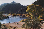
Ojo Feliz from Cerro Montoso
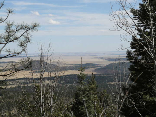
Photo by Don Hamilton